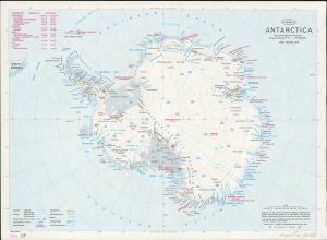
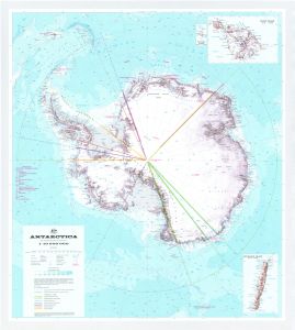
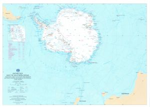
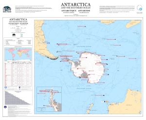
Antarctic Maps
Small scale maps covering scales above 1:250 000
-
that cover
| 51° 05' 48.1" S to 54° 39' 32.0" S |
| 69° 59' 40.6" E to 74° 48' 19.4" E |
For additional maps, see the Mapping for the Map Catalogue.
Use the link on the Map No or the preview if it exists to see full details.
| Map No | Map Title | Year | Scale | Preview |
|---|---|---|---|---|
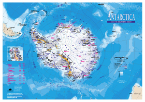
| 13308 | A Planning Chart for the Antarctic Region | 2005 | 1 : 15 000 000 | |
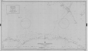
| 563 | A.N.A.R.E. Track Chart M.S. Nella Dan - Melbourne - Petersen Bank - Mawson - Petersen Bank - Hobart - Macquarie Island - Melbourne Dec.1966 / March 1967 | 1967 | 1 : 8 500 000 |
 |
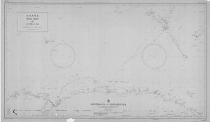
| 593 | A.N.A.R.E. Track Chart of M.S. Nella Dan December 1963 - April 1964 | 1964 | 1 : 8 500 000 |
 |
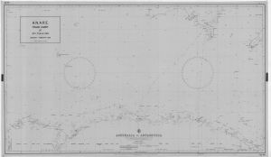
| 572 | A.N.A.R.E. Track Chart of M.S. Nella Dan December 1965 - March 1966 | 1966 | 1 : 8 500 000 |
 |
| 566 | A.N.A.R.E. Track Chart of M.S. Nella Dan December 1967 to April 1968 | 1968 | 1 : 8 500 000 |
 |
| 565 | A.N.A.R.E. Track Chart of M.S. Nella Dan December 1968 - March 1969 | 1969 | 1 : 8 500 000 |
 |
| 569 | A.N.A.R.E. Track Chart of M.S. Nella Dan November 1969 - March 1970 | 1970 | 1 : 8 500 000 |
 |
| 574 | A.N.A.R.E. Track Chart of M.S. Thala Dan January 1966 - February 1966 | 1966 | 1 : 8 500 000 |
 |
| 567 | A.N.A.R.E. Track Chart of M.S. Thala Dan January 1968 - February 1968 | 1968 | 1 : 8 500 000 |
 |
| 564 | A.N.A.R.E. Track Chart of M.S. Thala Dan January 1969 - March 1969 | 1969 | 1 : 8 500 000 |
 |
| 586 | A.N.A.R.E. Track Chart of M.V. Nella Dan December 1964 - March 1965 | 1965 | 1 : 8 500 000 |
 |
| 579 | A.N.A.R.E. Track Chart of M.V. Thala Dan January - February 1965 | 1965 | 1 : 8 500 000 |
 |
| 550 | A.N.A.R.E. Track Chart of Thala Dan - Wilkes Party plus 13 Frenchmen Melbourne / Dumont d'Urville / Wilkes - 1967 Voyage | 1967 | 1 : 8 500 000 |
 |
| 12763 | ADMAP/ Magnetic Anomaly Map of the Antarctic | 2000 | 1 : 10 000 000 | |
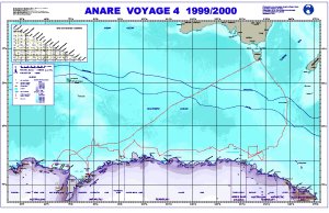
| 12715 | ANARE Voyage 4 1999/2000 | 2000 | 1 : 8 500 000 |
 |
| 12764 | Antarctica | 1999 | 1 : 10 000 000 |
 |
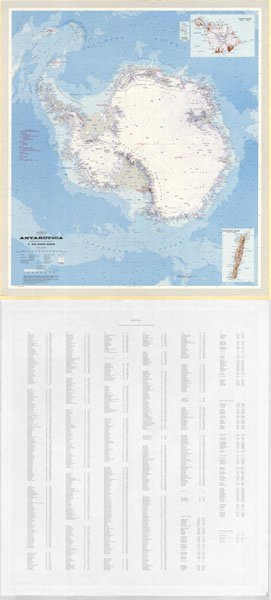
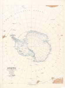
| 5490 | Antarctica | 1957 | 1 : 10 000 000 | |
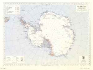
| 5161 | Antarctica | 1979 | 1 : 10 000 000 |
 |
| 5162 | Antarctica | 1979 | 1 : 20 000 000 |
 |
| 13471 | Antarctica | 1939 | 1 : 10 000 000 |
 |
| 13780 | Antarctica | 1977 | 1 : 20 000 000 |
 |
| 268 | Antarctica | 1986 | 1 : 20 000 000 |
 |
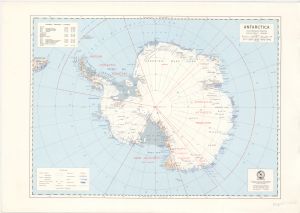
| 151 | Antarctica | 1979 | 1 : 10 000 000 |
 |
| 152 | Antarctica | 1986 | 1 : 10 000 000 |
 |
| 1216 | Antarctica | 1965 | 1 : 20 000 000 |
 |
| 2674 | Antarctica | 1974 | 1 : 15 000 000 |
 |
| 2675 | Antarctica | 1979 | 1 : 20 000 000 | |
| 3655 | Antarctica | 1970 | 1 : 5 000 000 | |
| 3656 | Antarctica | 1 : 5 000 000 | ||
| 14063 | Antarctica | 1965 | 1 : 20 000 000 |
 |
| 14064 | Antarctica | 1986 | 1 : 20 000 000 |
 |
| 14065 | Antarctica | 1979 | 1 : 20 000 000 |
 |
| 14091 | Antarctica | 2003 | 1 : 5 500 000 | |
| 14161 | Antarctica | 1956 | 1 : 10 000 000 |
 |
| 13951 | Antarctica - with claims | 1986 | 1 : 10 000 000 |
 |
| 3648 | Antarctica (1800-1838) The Age of the Sealer | 1 : 11 250 000 | ||
| 3650 | Antarctica (1838-1897)-Wilkes-Ross-d'Urville | 1 : 11 250 000 | ||
| 3653 | Antarctica (1897-1928) - Penetration of the Continent | 1 : 11 250 000 | ||
| 3652 | Antarctica (1928-1939)-Technical Revolution in Exploration | 1 : 11 250 000 | ||
| 3651 | Antarctica (1939-1945) Official Expeditions and Permanent Bases | 1 : 11 250 000 | ||
| 3654 | Antarctica (1945-1956) "Highjump" through "Deep Freeze" I | 1 : 11 250 000 | ||
| 3649 | Antarctica : Cook's Voyages (1772-73) (1773-75) | 1 : 11 250 000 | ||
| 14022 | Antarctica : US Navy Operation "Deep Freeze 68" 1967-68 | 1967 | 1 : 11 250 000 | |
| 2673 | Antarctica 1956 - 1960 | 1960 | 1 : 20 000 000 |
 |
| 158 | Antarctica and the Southern Ocean | 1992 | 1 : 20 000 000 |
 |
| 12965 | Antarctica and the Southern Ocean | 2003 | 1 : 16 950 000 |
 |
| 13115 | Antarctica and the Southern Ocean | 2005 | 1 : 20 000 000 |
 |
| 13939 | Antarctica and the Southern Ocean | 2011 | 1 : 20 000 000 |
 |
| 13476 | Antarctica and the Southern Ocean : illustrating Australian Antarctic Territory for the AAT 75th anniversary poster | 2008 | 1 : 20 000 000 |
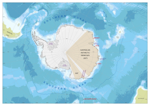 |
| 13374 | Antarctica and the Southern Ocean : Jurisdictional and Administrative Boundaries | 2007 | 1 : 17 000 000 |
 |
| 13158 | Antarctica and the Southern Ocean : Jurisdictional and Administrative Boundaries | 2006 | 1 : 17 000 000 |
 |
| 13032 | Antarctica and the Southern Ocean : Jurisdictional and Administrative Boundaries | 2003 | 1 : 17 000 000 |
|
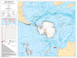
| 13281 | Antarctica and the Southern Ocean : main Antarctic facilities operated by the National Antarctic Programs in the Antarctic Treaty area (south of 60 deg. latitude south) | 2006 | 1 : 17 000 000 |
 |
| 13321 | Antarctica and the Southern Ocean: main Antarctic facilities operated by the National Antarctic Programs in the Antarctic Treaty area (south of 60° latitude south) [Folding map version] | 2006 | 1 : 17 000 000 | |
| 13405 | Antarctica exploration and claims as of 1 February 1956 | 1959 | 1 : 13 800 000 | |
| 5917 | Antarctica with Subglacial and Ocean Bottom Features [set] | 1962 | 1 : 10 000 000 |
 |
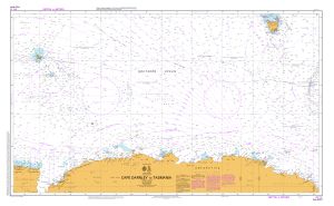
| 13208 | Aurora Australis tracks 1989/90 to 2003/04, Cape Darnley to Tasmania | 2004 | 1 : 10 000 000 |
 |
| 13213 | Aus 4074 Southern Ocean - Cape Darnley to Tasmania | 2004 | 1 : 10 000 000 |
 |
| 14602 | Aus 597 Australia - Southern Ocean - Approaches to Heard Island | 2015 | 1 : 1 500 000 |
 |
| 14050 | Australasian Antarctic Expedition illustrating sledging operations from the Western Base Station | 1 : c1 330 000 |
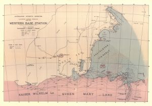 |
|
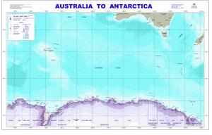
| 13060 | Australia to Antarctica | 2004 | 1 : 8 500 000 |
 |
| 11008 | Australia to Antarctica | 1999 | 1 : 8 500 000 |
 |
| 5170 | Australia to Antarctica | 1964 | 1 : 8 500 000 | |
| 293 | Australia to Antarctica | 1964 | 1 : 8 500 000 | |
| 294 | Australia to Antarctica | 1963 | 1 : 8 500 000 |
 |
| 295 | Australia to Antarctica | 1981 | 1 : 8 500 000 | |
| 296 | Australia to Antarctica | 1977 | 1 : 8 500 000 |
 |
| 299 | Australia to Antarctica | 1986 | 1 : 8 500 000 | |
| 300 | Australia to Antarctica | 1964 | 1 : 8 500 000 | |
| 278 | Australia to Antarctica | 1984 | 1 : 8 500 000 | |
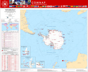
| 13861 | Australian Antarctic Program Voyage 2 2009/10 | 2010 | 1 : 15 000 000 |
 |
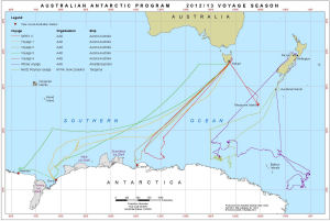
| 14212 | Australian Antarctic Program : 2012/13 Voyage Season | 2013 | 1 : 18 000 000 |
 |
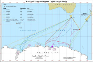
| 14291 | Australian Antarctic Program : 2013/14 Voyage Season | 2014 | 1 : 18 000 000 |
 |
| 14002 | Australia's Maritime Jurisdiction around Heard Island and McDonald Islands | 2010 | 1 : 3 000 000 |
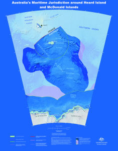 |
| 14005 | Australia's Maritime Jurisdiction around Heard Island and McDonald Islands | 2010 | 1 : 3 000 000 |
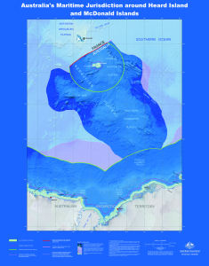 |
| 13531 | Authorized map of the Second Byrd Antarctic Expedition | 1934 | 1 : 17 500 000 |
 |
| 1212 | Base map of the Circum-Pacific Region, Antarctica | 1978 | 1 : 10 000 000 | |
| 13453 | Bathymetric chart of the Kerguelen Plateau | 1987 | 1 : 5 000 000 |
 |
| 12769 | BEDMAP - Bed topography of the Antarctic | 2000 | 1 : 10 000 000 | |
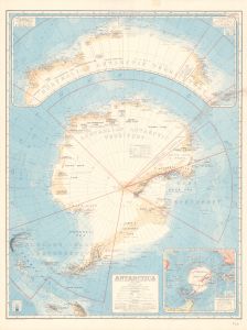
| 1360 | Chart of the South Polar Regions | 1905 | 1 : 14 000 000 |
 |
| 5188 | Chile en al Continente Antartico | 1987 | 1 : 20 000 000 | |
| 12730 | De Prince Edward Island A Heard Island - Iles Crozet,Kerguelen Et Amsterdam | 1998 | 1 : 4 000 000 |
 |
| 257 | Dronning Maud Land to Queen Mary Land showing Mawson & Davis | 1981 | 1 : 10 000 000 | |
| 13808 | Dronning Maud Land to Wilhelm II Land | 1976 | 1 : 2 750 000 | |
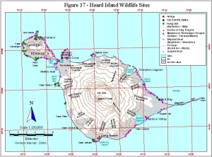
| 11401 | Figure 37 - Heard Island Wildlife Sites Helicopter Operations | 1999 | 1 : 250 000 |
 |
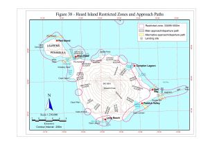
| 11402 | Figure 38 - Heard Island Restricted Zones and Approach Paths Helicopter Operations | 1999 | 1 : 250 000 |
 |
| 5321 | Free Air Gravity Anomaly Map, Antarctic Region | 1984 | 1 : 13 000 000 | |
| 5311 | Fremantle to Lars Christensen Coast | 1966 | 1 : 5 000 000 | |
| 5313 | Fremantle to Prince Harold Coast | 1968 | 1 : 8 000 000 | |
| 5295 | General Bathymetric Chart of the Oceans | 1970 | 1 : 10 000 000 | |
| 5298 | General Bathymetric Chart of the Oceans | 1967 | 1 : 10 000 000 | |
| 12963 | General bathymetric chart of the oceans (GEBCO) : 5.13 | 1981 | 1 : 10 000 000 | |
| 5934 | Geographic map of the Circum-Pacific Region, Antarctica | 1978 | 1 : 10 000 000 | |
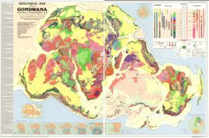
| 13401 | Geological map of sectors of Gondwana reconstructed to their disposition 150 Ma | 1988 | 1 : 10 000 000 |
 |
| 2632 | Gravity map of the Antarctic - Sheet 2 | 1975 | 1 : 5 000 000 |
 |
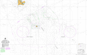
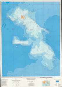
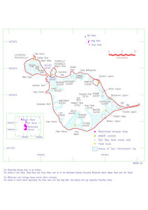
| 5243 | Heard & McDonald Islands | 1963 | 1 : 372 300 | |
| 5521 | Heard and McDonald Islands | 1 : 290 000 | ||
| 5880 | Heard and McDonald Islands | 1967 | 1 : 290 000 | |
| 13104 | Heard and McDonald Islands : Conservation Zones and Marine Reserves (OUT OF DATE) | 2004 | 1 : 4 750 000 |
 |
| 14034 | Heard and McDonald Islands after Capt. G.S. Nares of the Challenger Expedition 1874 | 1874 | 1 : 325 000 |
 |
| 26 | Heard Island - bay closing lines | 1997 | 1 : 270 000 |
 |
| 122 | Heard Island (1:1 million bathymetric map and soundings map) | 1995 | 1 : 1 000 000 |
 |
| 13138 | Heard Island [Black and white] | 2005 | 1 : 853 600 |
 |
| 14168 | Heard Island and McDonald Islands | 1995 | 1 : c333 000 |
 |
| 14234 | Heard Island and McDonald Islands Marine Reserve | 2014 | 1 : 2 400 000 |
 |
| 14357 | Heard Island and McDonald Islands Marine Reserve | 2015 | 1 : 3 800 000 |
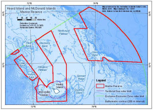 |
| 12929 | Heard Island and McDonald Islands Marine Reserve (OUT OF DATE) | 2003 | 1 : 3 409 000 |
 |
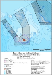
| 12914 | Heard Island and McDonald Islands Marine Reserve and Conservation Zone (OUT OF DATE) | 2002 | 1 : 5 000 000 |
 |
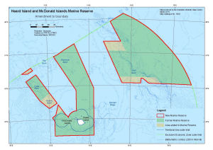
| 14286 | Heard Island and McDonald Islands Marine Reserve Amendment to boundary |
2014 | 1 : 3 380 000 |
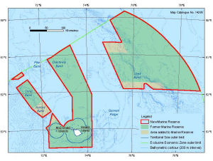 |
| 14221 | Heard Island and McDonald Islands Marine Reserve Amendment to boundary |
2014 | 1 : 2 400 000 |
 |
| 12913 | HIMI Marine Reserve and Conservation Zone (OUT OF DATE) | 2002 | 1 : 3 738 000 |
 |
| 3458 | Index to topographic maps of the Geological Survey Antarctica | 1968 | 1 : 10 000 000 | |
| 3459 | Index to United States topographic and other map coverage of Antarctica | 1984 | 1 : 10 000 000 | |
| 12958 | Index to United States topographic and other map coverage of Antarctica | 1984 | 1 : 10 000 000 |
 |
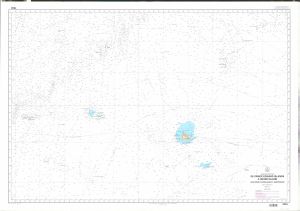
| 5432 | Indian Ocean, Antarctic Coast: Heard Island to Knox Coast | 1958 | 1 : 2 500 000 |
 |
| 5431 | Indian Ocean, Antarctic Coast: Prince Edward Islands to Enderby Land, including Crozet and Kerguelen Islands | 1958 | 1 : 2 500 000 |
 |
| 5551 | Islands in the Indian Ocean | 1984 | 1 : 290 000 | |
| 5548 | Kapp Norvegia to Iles Kerguelen | 1984 | 1 : 10 000 000 | |
| 284 | Kapp Norvegia to Iles Kerguelen | 1997 | 1 : 10 000 000 | |
| 345 | Kapp Norvegia to lles Kerguelen | 1991 | 1 : 10 000 000 | |
| 410 | Kerguelen Plateau | 1979 | 1 : 10 000 000 | |
| 12915 | Kerguelen Plateau and the Heard Island and McDonald Islands Marine Reserve and Conservation Zone (OUT OF DATE) | 2002 | 1 : 10 000 000 |
 |
| 424 | Kerguelen Plateau Bathymetric Map - Sheet 2 | 1989 | 1 : 500 000 |
 |
| 13455 | Kerguelen Plateau Ecosystem Model Polygons | 2007 | 1 : 10 880 000 |
 |
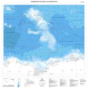
| 14033 | Kerguelen Plateau to Antarctica | 2013 | 1 : 4 000 000 |
 |
| 14032 | Locations of Antarctic Specially Protected Areas | 2012 | 1 : 10 550 000 |
 |
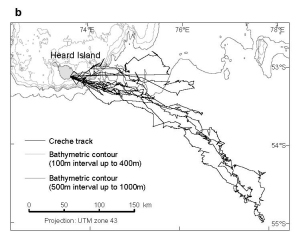
| 13449 | Macaroni penguin creche stage foraging trips from Heard Island, 2003/04 summer | 2007 | 1 : 4 500 000 |
 |
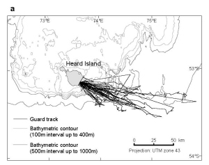
| 13448 | Macaroni penguin guard stage foraging trips from Heard Island, 2003/04 summer | 2007 | 1 : 2 800 000 |
 |
| 2587 | Mac-Robertson Land to Dronning Mary Land | 1954 | 1 : 3 250 000 | |
| 2588 | Mac-Robertson Land to Dronning Mary Land | 1961 | 1 : 3 250 000 | |
| 2540 | Map of the Antarctic Regions / With Claims | 1963 | 1 : 16 000 000 | |
| 2142 | Map of Antarctic Geology | 1961 | 1 : 10 000 000 | |
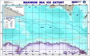
| 12342 | Maximum Sea Ice Extent | 2000 | 1 : 8 500 000 |
 |
| 528 | Nella Dan Voyage 1 (ADBEX III) 16 Sept. - 29 Dec. 1985 | 1985 | 1 : 8 500 000 |
 |
| 255 | Pacific Antarctic Ridge | 1982 | 1 : 10 000 000 | |
| 13011 | Physical features of the Southern Ocean | 2002 | 1 : 20 000 000 |
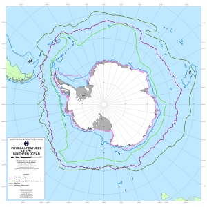 |
| 5936 | Plate-Tectonic Map of the Circum-Pacific Region : Antarctic Sheet | 1983 | 1 : 10 000 000 | |
| 210 | Plotting Sheet - 48? to 60? | 1958 | 1 : 1 000 000 | |
| 221 | Plotting Sheet - 48` to 54` | 1961 | 1 : 250 000 | |
| 216 | Plotting Sheet - 48` to 60` | 1975 | 1 : 1 000 000 | |
| 217 | Plotting Sheet - 48` to 60` | 1980 | 1 : 1 000 000 | |
| 3695 | Preliminary Chart showing the Deep Sea Soundings taken on board the "Aurora" during the 1st and 2nd years work of the Australasian Antarctic Expedition under Dr. Douglas Mawson 1912-13. | 1913 | 1 : 15 000 000 |
 |
| 369 | Puerto Santa Cruz to Cabo Pilar, including Falkland Islands | 1987 | 1 : 1 750 000 | |
| 3696 | Regional Map showing the area covered by the Australasian Antarctic Expedition 1911-14 under Sir Douglas Mawson | 1914 | 1 : 15 000 000 |
 |
| 2671 | Relief of the Antarctic | 1960 | 1 : 12 000 000 |
 |
| 254 | Scotia and Weddell Seas | 1981 | 1 : 10 000 000 | |
| 13007 | Ship track maps. Sheet 1 : Tasmania to Antarctica | 1998 | 1 : 9 000 000 |
 |
| 3684 | Sketch Maps showing the Track and Explorations of the German South Polar Expedition 1902-3 by Dr. Von Drygalski. | 1904 | 1 : 6 000 000 |
 |
| 14346 | Southern Ocean Bathymetry 50°E to 170°E, 40°S to 70°S |
2015 | 1 : 17 000 000 |
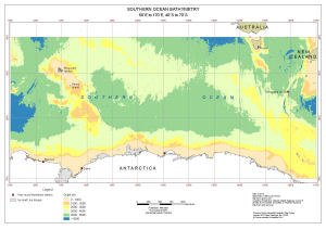 |
| 5356 | Sydishavet | 1962 | 1 : 3 250 000 |
 |
| 5362 | Sydishavet | 1964 | 1 : 10 000 000 | |
| 13552 | Sydishavet : fra 50 deg. til 73 deg. S.BR. og fra 20 deg. til 110 deg. O.LGD. | 1936 | 1 : 5 000 000 |
 |
| 14290 | Territory of Heard Island and McDonald Islands Prohibited Area |
2014 | 1 : 2 400 000 |
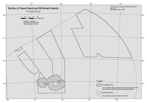 |
| 654 | Thala Dan 1959 / Mawson - Davis - Melbourne [Sheet 5] | 1959 | 1 : 1 000 000 |
 |
| 573 | Thala Dan 1966 / Tasmania - Casey via Dumont d'Urville | 1966 | 1 : 8 500 000 |
 |
| 549 | Thala Dan 1967 / Wilkes Party plus 13 Frenchmen, Melbourne - Dumont d'Urville - Wilkes | 1967 | 1 : 8 500 000 |
 |
| 699 | Thala Dan Track Chart -1958 | 1958 | 1 : 1 000 000 | |
| 13812 | The Antarctic | 1955 | 1 : 2 750 000 | |
| 3645 | The Antarctic Regions | 1932 | 1 : 16 000 000 |
 |
| 12759 | The Australian Territory of Heard Island & McDonald Islands Limits of the Australian Fishing Zone and Exclusive Economic Zone |
1997 | 1 : 4 000 000 | |
| 30 | The Australian Territory of Heard Island & McDonald Islands Limits of the Territorial Sea |
1997 | 1 : 400 000 | |
| 3677 | The South Polar Regions to Illustrate the Paper by Staff Commander J.E. Davis. | 1869 | 1 : 16 000 000 |
 |
| 13087 | Topographic data managed by the Australian Antarctic Data Centre | 2004 | 1 : 6 000 000 |
 |
| 3499 | USAF Aerospace Planning Chart | 1962 | 1 : 9 000 000 | |
| 3494 | USAF Global Navigation and Planning Chart: Antarctica GNC26 | 1961 | 1 : 5 000 000 | |
| 3495 | USAF Global Navigation and Planning Chart: Antarctica GNC26N | 1961 | 1 : 5 000 000 | |
| 3490 | USAF Global Navigation and Planning Chart: Indian Ocean GNC22 | 1960 | 1 : 5 000 000 | |
| 3493 | USAF Global Navigation and Planning Chart: New Zealand GNC25 | 1960 | 1 : 5 000 000 | |
| 13926 | USAF Global Navigation Chart GNC21 | 1983 | 1 : 5 000 000 | |
| 5722 | USAF Global Navigation Chart GNC26 | 1985 | 1 : 5 000 000 | |
| 5751 | World Aeronautical Chart. Heard Island | 1954 | 1 : 1 000 000 |