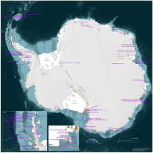
Antarctic Maps
Small scale maps covering scales above 1:250 000
-
that cover
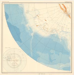
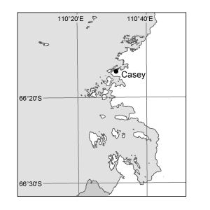
| 64° 50' 28.3" S to 68° 20' 35.5" S |
| 106° 30' 39.6" E to 112° 38' 49.2" E |
For additional maps, see the Mapping for the Map Catalogue.
Use the link on the Map No or the preview if it exists to see full details.
| Map No | Map Title | Year | Scale | Preview |
|---|---|---|---|---|
| 13308 | A Planning Chart for the Antarctic Region | 2005 | 1 : 15 000 000 | |
| 563 | A.N.A.R.E. Track Chart M.S. Nella Dan - Melbourne - Petersen Bank - Mawson - Petersen Bank - Hobart - Macquarie Island - Melbourne Dec.1966 / March 1967 | 1967 | 1 : 8 500 000 |
 |
| 593 | A.N.A.R.E. Track Chart of M.S. Nella Dan December 1963 - April 1964 | 1964 | 1 : 8 500 000 |
 |
| 572 | A.N.A.R.E. Track Chart of M.S. Nella Dan December 1965 - March 1966 | 1966 | 1 : 8 500 000 |
 |
| 566 | A.N.A.R.E. Track Chart of M.S. Nella Dan December 1967 to April 1968 | 1968 | 1 : 8 500 000 |
 |
| 565 | A.N.A.R.E. Track Chart of M.S. Nella Dan December 1968 - March 1969 | 1969 | 1 : 8 500 000 |
 |
| 569 | A.N.A.R.E. Track Chart of M.S. Nella Dan November 1969 - March 1970 | 1970 | 1 : 8 500 000 |
 |
| 574 | A.N.A.R.E. Track Chart of M.S. Thala Dan January 1966 - February 1966 | 1966 | 1 : 8 500 000 |
 |
| 567 | A.N.A.R.E. Track Chart of M.S. Thala Dan January 1968 - February 1968 | 1968 | 1 : 8 500 000 |
 |
| 564 | A.N.A.R.E. Track Chart of M.S. Thala Dan January 1969 - March 1969 | 1969 | 1 : 8 500 000 |
 |
| 586 | A.N.A.R.E. Track Chart of M.V. Nella Dan December 1964 - March 1965 | 1965 | 1 : 8 500 000 |
 |
| 579 | A.N.A.R.E. Track Chart of M.V. Thala Dan January - February 1965 | 1965 | 1 : 8 500 000 |
 |
| 550 | A.N.A.R.E. Track Chart of Thala Dan - Wilkes Party plus 13 Frenchmen Melbourne / Dumont d'Urville / Wilkes - 1967 Voyage | 1967 | 1 : 8 500 000 |
 |
| 692 | A.N.A.R.E. Track Chart Thala Dan 1958 [Sheet 6] | 1958 | 1 : 1 000 000 |
 |
| 691 | A.N.A.R.E. Track Chart Thala Dan 1958 [Sheet 7] | 1958 | 1 : 1 000 000 |
 |
| 12763 | ADMAP/ Magnetic Anomaly Map of the Antarctic | 2000 | 1 : 10 000 000 | |
| 13857 | Aerial Photography Flight Lines from Operation Highjump 1946/47 on map SQ 42-43 | 1947 | 1 : 1 000 000 |
 |
| 12953 | Aerial photography flight lines on SQ 47-48 | 1973 | 1 : 1 000 000 |
 |
| 13592 | Aerial photography flight lines on SQ 48-49 | 1964 | 1 : 1 000 000 |
 |
| 12952 | Aerial photography flight lines on SQ 49-50 | 1973 | 1 : 1 000 000 |
 |
| 3476 | Air Navigation Chart Antarctica: New Schwabenland-South Pole | 1967 | 1 : 2 188 800 | |
| 3477 | Air Navigation Chart Antarctica: New Schwabenland-South Pole | 1968 | 1 : 2 188 800 | |
| 3478 | Air Navigation Chart Antarctica: Wilkes Land | 1966 | 1 : 2 188 800 | |
| 12879 | ANARE Air Operations Map (1994-1995 Season) | 1994 | 1 : 2 000 000 |
 |
| 14041 | ANARE air photography flight indexes [Set] | 1973 | 1 : 1 000 000 | |
| 498 | ANARE Magga Dan Track 1960 | 1960 | 1 : 1 000 000 |
 |
| 2011 | ANARE Seismic / Southern Traverses | 1962 | 1 : 500 000 | |
| 12715 | ANARE Voyage 4 1999/2000 | 2000 | 1 : 8 500 000 |
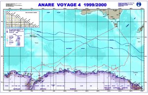 |
| 5092 | Antarctic Continent | 1954 | 1 : 6 000 000 |
 |
| 3429 | Antarctic Ice Sheet Thickness and Volume | 1983 | 1 : 10 000 000 | |
| 3508 | Antarctic Reconnaissance Preliminary Base : Australian Quadrant E2-64-10 | 1956 | 1 : 500 000 |
 |
| 3513 | Antarctic Reconnaissance Preliminary Base : Australian Quadrant E2-66-10 | 1956 | 1 : 500 000 |
 |
| 3512 | Antarctic Reconnaissance Preliminary Base : Australian Quadrant E2-66-9 | 1960 | 1 : 500 000 |
 |
| 3507 | Antarctic Reconnaissance Preliminary Base, Australian Quadrant | 1960 | 1 : 500 000 | |
| 5451 | Antarctic Relief | 1986 | 1 : 12 000 000 | |
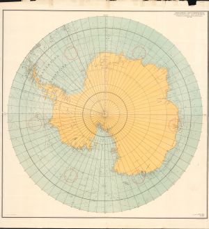
| 5452 | Antarctica | 1980 | 1 : 20 000 000 |
 |
| 5490 | Antarctica | 1957 | 1 : 10 000 000 | |
| 5161 | Antarctica | 1979 | 1 : 10 000 000 |
 |
| 5162 | Antarctica | 1979 | 1 : 20 000 000 |
 |
| 3655 | Antarctica | 1970 | 1 : 5 000 000 | |
| 3656 | Antarctica | 1 : 5 000 000 | ||
| 2674 | Antarctica | 1974 | 1 : 15 000 000 |
 |
| 2675 | Antarctica | 1979 | 1 : 20 000 000 | |
| 2677 | Antarctica | 1959 | 1 : 3 000 000 | |
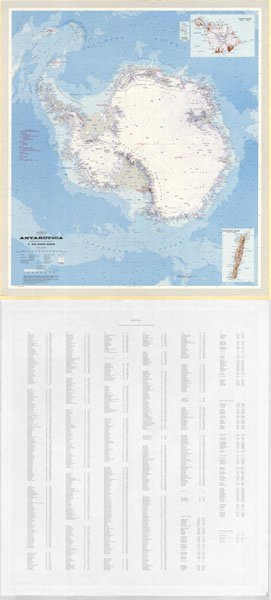
| 12764 | Antarctica | 1999 | 1 : 10 000 000 |
 |
| 12781 | Antarctica | 2000 | 1 : 10 000 000 | |
| 2535 | Antarctica | 1994 | 1 : 12 500 000 | |
| 1216 | Antarctica | 1965 | 1 : 20 000 000 |
 |
| 1290 | Antarctica | 1970 | 1 : 9 800 000 | |
| 2554 | Antarctica | 1958 | 1 : 7 500 000 |
 |
| 2666 | Antarctica | 1975 | 1 : 10 000 000 |
 |
| 2667 | Antarctica | 1959 | 1 : 10 000 000 |
 |
| 2650 | Antarctica | 1980 | 1 : 10 000 000 |
 |
| 1206 | Antarctica | 1961 | 1 : 10 000 000 |
 |
| 267 | Antarctica | 1 : 250 000 | ||
| 268 | Antarctica | 1986 | 1 : 20 000 000 |
 |
| 151 | Antarctica | 1979 | 1 : 10 000 000 |
 |
| 152 | Antarctica | 1986 | 1 : 10 000 000 |
 |
| 14063 | Antarctica | 1965 | 1 : 20 000 000 |
 |
| 14064 | Antarctica | 1986 | 1 : 20 000 000 |
 |
| 14065 | Antarctica | 1979 | 1 : 20 000 000 |
 |
| 14091 | Antarctica | 2003 | 1 : 5 500 000 | |
| 14161 | Antarctica | 1956 | 1 : 10 000 000 |
 |
| 14195 | Antarctica | 2003 | 1 : 10 000 000 | |
| 13569 | Antarctica | 2008 | 1 : 8 000 000 | |
| 13780 | Antarctica | 1977 | 1 : 20 000 000 |
 |
| 13122 | Antarctica | 2004 | 1 : 10 000 000 |
 |
| 13471 | Antarctica | 1939 | 1 : 10 000 000 |
 |
| 14310 | Antarctica | 2010 | 1 : 10 000 000 | |
| 14463 | Antarctica | 2015 | 1 : 5 500 000 |
 |
| 15291 | Antarctica | 2018 | 1 : 10 000 000 |
 |
| 2668 | Antarctica 1956 - 1959 Expeditions | 1959 | 1 : 10 000 000 |
 |
| 2662 | Antarctica - East | 1976 | 1 : 5 000 000 |
 |
| 3425 | Antarctica - Radio Echo Sounding Map Series A. | 1974 | 1 : 5 000 000 | |
| 13951 | Antarctica - with claims | 1986 | 1 : 10 000 000 |
 |
| 3648 | Antarctica (1800-1838) The Age of the Sealer | 1 : 11 250 000 | ||
| 3650 | Antarctica (1838-1897)-Wilkes-Ross-d'Urville | 1 : 11 250 000 | ||
| 3653 | Antarctica (1897-1928) - Penetration of the Continent | 1 : 11 250 000 | ||
| 3652 | Antarctica (1928-1939)-Technical Revolution in Exploration | 1 : 11 250 000 | ||
| 3651 | Antarctica (1939-1945) Official Expeditions and Permanent Bases | 1 : 11 250 000 | ||
| 3654 | Antarctica (1945-1956) "Highjump" through "Deep Freeze" I | 1 : 11 250 000 | ||
| 8378 | Antarctica (the height of the geoid above spheroid contours of N) | 1979 | 1 : 20 000 000 | |
| 3649 | Antarctica : Cook's Voyages (1772-73) (1773-75) | 1 : 11 250 000 | ||
| 12960 | Antarctica : satellite image map of Antarctica | 1991 | 1 : 5 000 000 | |
| 14022 | Antarctica : US Navy Operation "Deep Freeze 68" 1967-68 | 1967 | 1 : 11 250 000 | |
| 2673 | Antarctica 1956 - 1960 | 1960 | 1 : 20 000 000 |
 |
| 3501 | Antarctica Aerial Photographic Coverage | 1950 | 1 : 14 400 000 | |
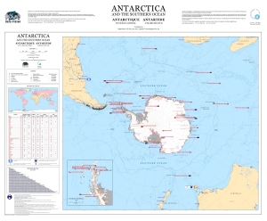
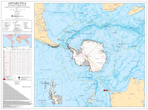
| 12761 | Antarctica and the Southern Ocean | 2000 | 1 : 20 000 000 |
 |
| 155 | Antarctica and the Southern Ocean | 1996 | 1 : 20 000 000 |
 |
| 158 | Antarctica and the Southern Ocean | 1992 | 1 : 20 000 000 |
 |
| 13939 | Antarctica and the Southern Ocean | 2011 | 1 : 20 000 000 |
 |
| 12965 | Antarctica and the Southern Ocean | 2003 | 1 : 16 950 000 |
 |
| 13115 | Antarctica and the Southern Ocean | 2005 | 1 : 20 000 000 |
 |
| 13476 | Antarctica and the Southern Ocean : illustrating Australian Antarctic Territory for the AAT 75th anniversary poster | 2008 | 1 : 20 000 000 |
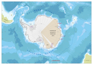 |
| 13374 | Antarctica and the Southern Ocean : Jurisdictional and Administrative Boundaries | 2007 | 1 : 17 000 000 |
 |
| 13158 | Antarctica and the Southern Ocean : Jurisdictional and Administrative Boundaries | 2006 | 1 : 17 000 000 |
 |
| 13032 | Antarctica and the Southern Ocean : Jurisdictional and Administrative Boundaries | 2003 | 1 : 17 000 000 |
|
| 13281 | Antarctica and the Southern Ocean : main Antarctic facilities operated by the National Antarctic Programs in the Antarctic Treaty area (south of 60 deg. latitude south) | 2006 | 1 : 17 000 000 |
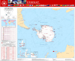 |
| 14184 | Antarctica and the Southern Ocean floor map | 2012 | 1 : 980 000 |
 |
| 13321 | Antarctica and the Southern Ocean: main Antarctic facilities operated by the National Antarctic Programs in the Antarctic Treaty area (south of 60° latitude south) [Folding map version] | 2006 | 1 : 17 000 000 | |
| 13405 | Antarctica exploration and claims as of 1 February 1956 | 1959 | 1 : 13 800 000 | |
| 14353 | Antarctica Radio Echo Sounding Map Series A | 1974 | 1 : 5 000 000 | |
| 3426 | Antarctica Radio Echo Sounding Map Series A | 1974 | 1 : 5 000 000 | |
| 5950 | Antarctica Reconnaissance Preliminary Base : Australian Quadrant E2-64-9 | 1961 | 1 : 500 000 |
 |
| 5917 | Antarctica with Subglacial and Ocean Bottom Features [set] | 1962 | 1 : 10 000 000 |
 |
| 5389 | Antarctica, Mawson Sea and Davis Sea | 1979 | 1 : 2 000 000 | |
| 13393 | Antarctica. Sheet 1 | 1939 | 1 : 7 500 000 |
 |
| 1059 | Antarctica. Sheet 2: Coastal Regions of the Australian Antarctic Territory | 1939 | 1 : 5 250 000 |
 |
| 160 | Antarctica-Geoid Map | 1990 | 1 : 20 000 000 |
 |
| 8325 | Antarctique - Vue D'Ensemble sur le Reseau des Principaux Lineaments | 1977 | 1 : 10 000 000 | |
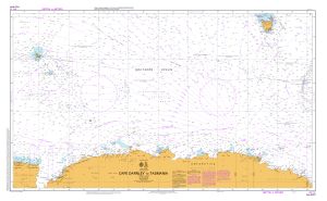
| 13208 | Aurora Australis tracks 1989/90 to 2003/04, Cape Darnley to Tasmania | 2004 | 1 : 10 000 000 |
 |
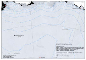
| 14265 | Aurora Basin North Ice Core Drilling Site Location in relation to Casey, Dumont d'Urville and Concordia |
2013 | 1 : 5 000 000 |
 |
| 14254 | Aurora Basin North Ice Core Drilling Site Traverse route planned for the 2013/14 summer season |
2013 | 1 : 17 000 000 |
 |
| 13213 | Aus 4074 Southern Ocean - Cape Darnley to Tasmania | 2004 | 1 : 10 000 000 |
 |
| 11551 | Aus 454 Australian Antarctic Territory - Wilkes Land - Mill Island to Cape Poinsett | 1998 | 1 : 500 000 |
 |
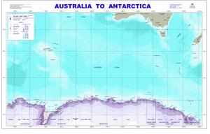
| 11008 | Australia to Antarctica | 1999 | 1 : 8 500 000 |
 |
| 5170 | Australia to Antarctica | 1964 | 1 : 8 500 000 | |
| 278 | Australia to Antarctica | 1984 | 1 : 8 500 000 | |
| 293 | Australia to Antarctica | 1964 | 1 : 8 500 000 | |
| 294 | Australia to Antarctica | 1963 | 1 : 8 500 000 |
 |
| 295 | Australia to Antarctica | 1981 | 1 : 8 500 000 | |
| 296 | Australia to Antarctica | 1977 | 1 : 8 500 000 |
 |
| 299 | Australia to Antarctica | 1986 | 1 : 8 500 000 | |
| 300 | Australia to Antarctica | 1964 | 1 : 8 500 000 | |
| 13060 | Australia to Antarctica | 2004 | 1 : 8 500 000 |
 |
| 12881 | Australian Antarctic Air Transport System, Map 2: Casey region | 2002 | 1 : c296 000 |
 |
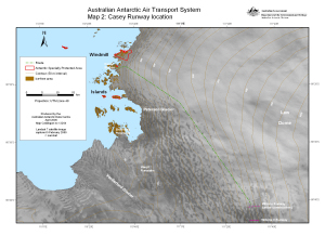
| 12924 | Australian Antarctic Air Transport System, Map 2: Casey Runway location | 2003 | 1 : 350 300 |
 |
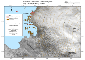
| 13264 | Australian Antarctic Air Transport System, Map 2: Casey Runway location | 2006 | 1 : 350 800 |
 |
| 13344 | Australian Antarctic Air Transport System, Map 2: Casey Runway location | 2006 | 1 : 350 800 |
 |
| 13861 | Australian Antarctic Program Voyage 2 2009/10 | 2010 | 1 : 15 000 000 |
 |
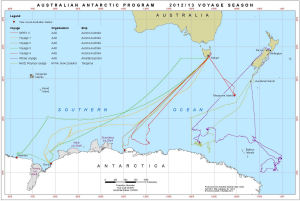
| 14212 | Australian Antarctic Program : 2012/13 Voyage Season | 2013 | 1 : 18 000 000 |
 |
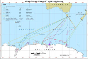
| 14291 | Australian Antarctic Program : 2013/14 Voyage Season | 2014 | 1 : 18 000 000 |
 |
| 13963 | Australian Antarctic Territory Sheet 43E [Budd Coast / Sabrina Coast] | 1958 | 1 : 2 000 000 |
 |
| 14019 | Australian Antarctic Territory Sheet 43W [Bunger Hills / Knox Coast] | 1958 | 1 : 2 000 000 |
 |
| 14 | Australian National Antarctic Research Expeditions 1947 to 1966 | 1989 | 1 : 6 000 000 |
 |
| 3518 | Australian Quadrant Knox Coast Experimental Chart | 1993 | 1 : 1 000 000 | |
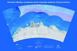
| 14000 | Australia's Maritime Jurisdiction off the Australian Antarctic Territory (Centre) | 2010 | 1 : 2 000 000 |
 |
| 14007 | Australia's maritime jurisdiction off the Australian Antarctica Territory | 2010 | 1 : 1 800 000 |
 |
| 13531 | Authorized map of the Second Byrd Antarctic Expedition | 1934 | 1 : 17 500 000 |
 |
| 13977 | Aviation Map: Cape Peremennyy to Totten Glacier | 2011 | 1 : 1 000 000 |
 |
| 1212 | Base map of the Circum-Pacific Region, Antarctica | 1978 | 1 : 10 000 000 | |
| 8043 | Bathymetry | 1991 | 1 : 11 674 000 | |
| 12769 | BEDMAP - Bed topography of the Antarctic | 2000 | 1 : 10 000 000 | |
| 8179 | Bedrock relief of Antarctica | 1980 | 1 : 20 000 000 | |
| 8213 | Bottom sediments of the Southern Ocean | 1966 | 1 : 20 000 000 | |
| 8058 | Bouguer Gravity Anomalies | 1968 | 1 : 15 000 000 | |
| 1984 | Bowman Island | 1966 | 1 : 500 000 | |
| 13398 | British Antarctic Survey and International Polar Year 2007-2008 : Antarctica | 2007 | 1 : 10 000 000 | |
| 246 | Budd Coast and Dalton Iceberg Tongue | 1984 | 1 : 1 000 000 | |
| 5308 | Budd Coast to Lars Christensen Coast | 1967 | 1 : 3 000 000 | |
| 979 | Bunger Hills | 1968 | 1 : 1 000 000 | |
| 478 | Cape Elliott to Cape Poinsett | 1965 | 1 : 1 000 000 | |
| 1986 | Cape Peremennyy / Merritt Island | 1960 | 1 : 500 000 | |
| 1982 | Cape Poinsett | 1962 | 1 : 500 000 | |
| 1380 | Casey - Law Dome Southern Traverse Route 1984 |
1 : 2 000 000 |
 |
|
| 3660 | Central of five sheets - Copy of preliminary-reconaissance worksheet compiled from Operation Highjump photographs, part of ONR project 388-088 | 1955 | 1 : 1 000 000 | |
| 1360 | Chart of the South Polar Regions | 1905 | 1 : 14 000 000 |
 |
| 5188 | Chile en al Continente Antartico | 1987 | 1 : 20 000 000 | |
| 8045 | Crustal Structure | 1991 | 1 : 11 674 000 | |
| 13309 | Dome Argus and Vostok | 2006 | 1 : 13 000 000 |
 |
| 14162 | Draft - Antarctica : A.N.A.R.E. exploration 1948 to 1966 - Sheet 1 | 1987 | 1 : 6 000 000 |
 |
| 14166 | Draft - Antarctica : A.N.A.R.E. Exploration 1948-1966 | 1987 | 1 : 6 000 000 |
 |
| 257 | Dronning Maud Land to Queen Mary Land showing Mawson & Davis | 1981 | 1 : 10 000 000 | |
| 5390 | D'Urville Sea to Mawson Sea | 1979 | 1 : 2 000 000 | |
| 12935 | East Antarctica, Location of North-east Bailey Peninsula, Antarctic Specially Protected Area No. 135 | 2002 | 1 : 19 000 000 |
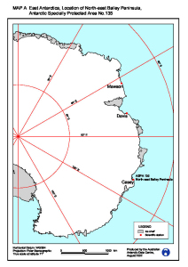 |
| 5251 | Enderby Land / South Pole | 1 : 5 000 000 | ||
| 11366 | Figure 2 - Windmill Islands and Casey Station Helicopter Operations | 1999 | 1 : 250 000 |
 |
| 11367 | Figure 3 - Wildlife in the Casey Area Helicopter Operations | 1999 | 1 : 250 000 |
 |
| 11368 | Figure 4 - Restricted zones near Casey Helicopter Operations | 1999 | 1 : 250 000 |
 |
| 8023 | Fossil map of Antarctica | 1970 | 1 : 10 000 000 | |
| 5321 | Free Air Gravity Anomaly Map, Antarctic Region | 1984 | 1 : 13 000 000 | |
| 8044 | Free Air Gravity Field | 1991 | 1 : 11 674 000 | |
| 8057 | Free-Air Gravity Anomalies | 1968 | 1 : 15 000 000 | |
| 5311 | Fremantle to Lars Christensen Coast | 1966 | 1 : 5 000 000 | |
| 5313 | Fremantle to Prince Harold Coast | 1968 | 1 : 8 000 000 | |
| 5296 | General Bathymetric Chart of the Oceans | 1955 | 1 : 10 000 000 | |
| 5297 | General Bathymetric Chart of the Oceans | 1954 | 1 : 10 000 000 | |
| 12963 | General bathymetric chart of the oceans (GEBCO) : 5.13 | 1981 | 1 : 10 000 000 | |
| 5934 | Geographic map of the Circum-Pacific Region, Antarctica | 1978 | 1 : 10 000 000 | |
| 8001 | Geologic Map of Antarctica | 1972 | 1 : 5 000 000 | |
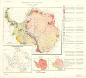
| 8025 | Geologic map of Antarctica | 1970 | 1 : 10 000 000 | |
| 8177 | Geologic Map of Antarctica | 1978 | 1 : 5 000 000 | |
| 3496 | Geologic Map of Antarctica | 1972 | 1 : 5 000 000 | |
| 8185 | Geological map of Antarctica | 1966 | 1 : 10 000 000 | |
| 8356 | Geological map of Antarctica | 1995 | 1 : 5 000 000 | |
| 13401 | Geological map of sectors of Gondwana reconstructed to their disposition 150 Ma | 1988 | 1 : 10 000 000 |
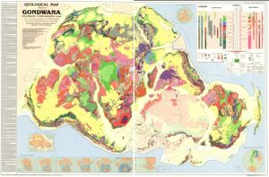 |
| 8004 | Geological Map of the Circum-Pacific Region. Antarctic Sheet | 1989 | 1 : 10 000 000 | |
| 8027 | Geomorphic features of Antarctica | 1970 | 1 : 10 000 000 | |
| 13790 | Glaciers named in May 2010 | 2010 | 1 : 8 600 000 |
 |
| 2631 | Gravity map of the Antarctic - Sheet 4 | 1975 | 1 : 5 000 000 |
 |
| 2645 | Gravity map of the Antarctic - Sheet 6 | 1968 | 1 : 3 000 000 | |
| 14034 | Heard and McDonald Islands after Capt. G.S. Nares of the Challenger Expedition 1874 | 1874 | 1 : 325 000 |
 |
| 13766 | Ice free areas of Antarctica: buffered by 5 km | 2010 | 1 : 7 700 000 |
 |
| 13810 | Index to Landsat Worldwide Reference Systems (WRS): Landsats 1, 2, 3, and 4; Sheet 21 | 1982 | 1 : 10 000 000 | |
| 3458 | Index to topographic maps of the Geological Survey Antarctica | 1968 | 1 : 10 000 000 | |
| 3459 | Index to United States topographic and other map coverage of Antarctica | 1984 | 1 : 10 000 000 | |
| 12958 | Index to United States topographic and other map coverage of Antarctica | 1984 | 1 : 10 000 000 |
 |
| 5439 | Indian Ocean, Antarctic Coast: Bowman Island to Cape Poinsett | 1958 | 1 : 500 000 |
 |
| 5398 | Indian Ocean, Antarctic Coast: Cape Poinsett to Cape Southard | 1961 | 1 : 500 000 |
 |
| 5432 | Indian Ocean, Antarctic Coast: Heard Island to Knox Coast | 1958 | 1 : 2 500 000 |
 |
| 5433 | Indian Ocean, Antarctic Coast: Knox Coast to Tasmania | 1958 | 1 : 2 500 000 |
 |
| 3431 | Isostatically Adjusted Bedrock Surface of Antarctica | 1983 | 1 : 10 000 000 | |
| 410 | Kerguelen Plateau | 1979 | 1 : 10 000 000 | |
| 711 | Kista Dan 1956 [Sheet C] | 1956 | 1 : 1 000 000 |
 |
| 713 | Kista Dan 1956 [Sheet E] | 1956 | 1 : 1 000 000 |
 |
| 714 | Kista Dan 1956 [Sheet F] | 1956 | 1 : 1 000 000 |
 |
| 682 | Kista Dan 1957 / To Mawson - From Vestfold Hills [Sheet 4] | 1957 | 1 : 1 000 000 |
 |
| 834 | Knox Coast & Budd Coast | 1962 | 1 : 1 000 000 | |
| 843 | Knox Coat, Bunger Hills and David Island | 1973 | 1 : 1 000 000 | |
| 2589 | Knox Land to Adelie Land | 1954 | 1 : 3 250 000 | |
| 13707 | Landsat image mosaic of Antarctica (LIMA) | 2007 | 1 : 10 000 000 | |
| 1381 | Law Dome - Wilkes Land | 1 : 2 000 000 | ||
| 13914 | Law Dome AAS 3121 Sites 2010-11 Map 1 |
2010 | 1 : 931 500 |
 |
| 14032 | Locations of Antarctic Specially Protected Areas | 2012 | 1 : 10 550 000 |
 |
| 640 | Magga Dan 1959 / Lewis - Wilkes - Lewis [Sheet 4] | 1959 | 1 : 1 000 000 |
 |
| 641 | Magga Dan 1959 / Wilkes - Virik Bank area [Sheet 5] | 1959 | 1 : 1 000 000 |
 |
| 675 | Magga Dan 1960 10th - 21st February / Vincennes Bay - Shackleton Ice Shelf | 1960 | 1 : 1 000 000 |
 |
| 676 | Magga Dan 1960 January - February | 1960 | 1 : 1 000 000 |
 |
| 667 | Magga Dan 1960 January - February | 1960 | 1 : 1 000 000 |
 |
| 668 | Magga Dan 1960 January - February | 1960 | 1 : 1 000 000 |
 |
| 669 | Magga Dan 1960 January - February | 1960 | 1 : 1 000 000 |
 |
| 670 | Magga Dan 1960 January - February / Voyeykov Ice Shelf - Wilkes | 1960 | 1 : 1 000 000 |
 |
| 629 | Magga Dan 1961 / Melbourne - Fremantle [Sheet 4] | 1961 | 1 : 1 000 000 |
 |
| 766 | Magga Dan A.N.A.R. Expedition led by Phillip Law 1959 / Wilkes area [Sheet 5] | 1959 | 1 : 1 000 000 |
 |
| 767 | Magga Dan A.N.A.R. Expedition led by Phillip Law 1959 [Sheet 4] | 1959 | 1 : 1 000 000 |
 |
| 786 | Magga Dan A.N.A.R.E. 1960 / Shackleton Ice Shelf - Vincennes Bay [Sheet 4] | 1960 | 1 : 1 000 000 |
 |
| 783 | Magga Dan A.N.A.R.E. 1960 / Wilkes - Paulding Bay [Sheet 7] | 1960 | 1 : 1 000 000 |
 |
| 785 | Magga Dan A.N.A.R.E. 1960 [Sheet 5] | 1960 | 1 : 1 000 000 |
 |
| 784 | Magga Dan A.N.A.R.E. 1960 [Sheet 6] | 1960 | 1 : 1 000 000 |
 |
| 646 | Magga Dan Track Chart - 1959 | 1959 | 1 : 1 000 000 |
 |
| 627 | Magga Dan Track Chart - 1961 / Scoble Glacier-Cape Poinsett | 1961 | 1 : 1 000 000 |
 |
| 624 | Magga Dan Track Chart - 1961 / Wilkes-Tomlin Glacier | 1961 | 1 : 1 000 000 |
 |
| 774 | Magga Dan Track chart / Wilkes | 1959 | 1 : 1 000 000 | |
| 8046 | Magnetic Anomalies | 1991 | 1 : 11 674 000 | |
| 8056 | Magnetic Anomalies of Short Wavelength | 1968 | 1 : 15 000 000 | |
| 8051 | Magnetic Horizontal Intensity (Epoch 1965) | 1968 | 1 : 15 000 000 | |
| 8050 | Magnetic Inclination or Dip (Epoch 1965) | 1968 | 1 : 15 000 000 | |
| 2643 | Magnetic map of the Antarctic - Sheet 6 | 1961 | 1 : 3 000 000 | |
| 2644 | Magnetic map of the Antarctic - Sheet 6 | 1976 | 1 : 3 000 000 | |
| 2633 | Magnetic map of the Antarctic - Sheet 9 | 1961 | 1 : 3 000 000 | |
| 2635 | Magnetic map of the Antarctic - Sheet 9 | 1968 | 1 : 3 000 000 | |
| 2636 | Magnetic map of the Antarctic - Sheet 9 | 1974 | 1 : 3 000 000 | |
| 12839 | Magnetic Maps 1975 of the Antarctic | 1978 | 1 : 15 000 000 | |
| 8054 | Magnetic Variation (Epoch 1965) | 1968 | 1 : 15 000 000 | |
| 2540 | Map of the Antarctic Regions / With Claims | 1963 | 1 : 16 000 000 | |
| 2142 | Map of Antarctic Geology | 1961 | 1 : 10 000 000 | |
| 5449 | Map of Antarctica (Sheet 2 of 9) | 1968 | 1 : 3 000 000 |
 |
| 3709 | Map to illustrate the paper on the "First Crossing of Antarctica" by Lincoln Ellsworth | 1937 | 1 : 12 000 000 |
 |
| 2552 | Maria Byrd Land | 1954 | 1 : 4 000 000 |
 |
| 359 | Maria Byrd Land to Southwest Pacific Basin | 1997 | 1 : 10 000 000 | |
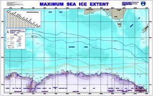
| 12342 | Maximum Sea Ice Extent | 2000 | 1 : 8 500 000 |
 |
| 607 | Nella Dan 1963 / Davis - Heard Island via Rendezvous with US Ship "Glacier" Helicopters | 1963 | 1 : 1 000 000 |
 |
| 561 | Nella Dan 1967 February - March / Return voyage [Sheet 4] | 1967 | 1 : 1 000 000 |
 |
| 557 | Nella Dan 1967 January - February | 1967 | 1 : 1 000 000 |
 |
| 560 | Nella Dan 1967 January - February | 1967 | 1 : 1 000 000 |
 |
| 598 | Nella Dan January - March 1964 | 1964 | 1 : 1 000 000 |
 |
| 599 | Nella Dan January - March 1964 / Approach to Wilkes | 1964 | 1 : 1 000 000 |
 |
| 547 | Nella Dan Ship track (Sheet No. 1) | 1972 | 1 : 1 000 000 |
 |
| 528 | Nella Dan Voyage 1 (ADBEX III) 16 Sept. - 29 Dec. 1985 | 1985 | 1 : 8 500 000 |
 |
| 2709 | Oasis | 1959 | 1 : 1 000 000 |
 |
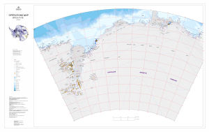
| 13468 | Operations Map: 105°E to 160°E | 2008 | 1 : 2 000 000 |
 |
| 13487 | Operations Map: 60°E to 115°E | 2009 | 1 : 2 000 000 |
 |
| 255 | Pacific Antarctic Ridge | 1982 | 1 : 10 000 000 | |
| 13011 | Physical features of the Southern Ocean | 2002 | 1 : 20 000 000 |
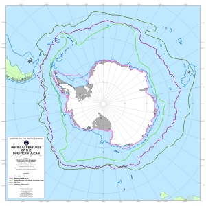 |
| 8061 | Physiographic and Tectonic Provinces | 1972 | 1 : 15 000 000 | |
| 5936 | Plate-Tectonic Map of the Circum-Pacific Region : Antarctic Sheet | 1983 | 1 : 10 000 000 | |
| 8003 | Plate-Tectonic Map of the Circum-Pacific Region. Antarctic Sheet | 1981 | 1 : 10 000 000 | |
| 223 | Plotting Sheet - 60` to 66` | 1961 | 1 : 250 000 | |
| 212 | Plotting Sheet - 66` to 72` | 1958 | 1 : 1 000 000 | |
| 703 | Portion of Australian Antarctic Territory showing cruise of Kista Dan and Photographic and Exploratory Flights by A.N.A.R.E. 1956 | 1957 | 1 : 6 000 000 |
 |
| 5474 | Pravda Coast (Bereg Pravdy) | 1975 | 1 : 2 500 000 | |
| 13631 | Protected Areas, Historic Sites and Monuments in the Australian Antarctic Territory | 2009 | 1 : 19 000 000 |
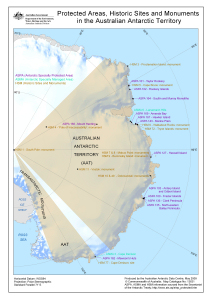 |
| 813 | Queen Mary Land and Wilkes Land Coast - 1956 and 1963 | 1956 | 1 : 1 000 000 | |
| 13174 | Radarsat image map of Antarctica | 2003 | 1 : 5 000 000 | |
| 8024 | Radiometric age map of Antarctica | 1970 | 1 : 10 000 000 | |
| 2671 | Relief of the Antarctic | 1960 | 1 : 12 000 000 |
 |
| 8055 | Residual Total Magnetic Intensity | 1968 | 1 : 15 000 000 | |
| 251 | Sabrina, Budd & Knox Coasts | 1972 | 1 : 1 000 000 | |
| 8241 | Schematic Geological Map of Antarctica | 1991 | 1 : 10 000 000 |
 |
| 8063 | Sea Floor Profiles (Sheet 1) | 1972 | 1 : 16 500 000 | |
| 8064 | Sea Floor Profiles (Sheet 2) | 1972 | 1 : c16 500 000 | |
| 8047 | Sediment Isopachs | 1991 | 1 : 11 674 000 | |
| 8383 | Sheet 2 The Surface of the Antarctic Ice Sheet | 1983 | 1 : 6 000 000 | |
| 8384 | Sheet 3 The Bedrock Surface of Antarctica | 1983 | 1 : 6 000 000 | |
| 8385 | Sheet 4 Antarctic Ice Sheet Thickness and Volume | 1983 | 1 : 10 000 000 | |
| 8386 | Sheet 5 Driving Stresses in the Antarctic Ice Sheet | 1983 | 1 : 8 000 000 | |
| 8387 | Sheet 6 Isostatically Adjusted Bedrock Surface of Antarctica | 1983 | 1 : 10 000 000 | |
| 108 | Sheet SQ 49-50/9, Vincennes Bay, Australian Antarctic Territory, Wilkes Land | 1969 | 1 : 250 000 |
 |
| 85 | Sheets SQ 49-50/10 & Part 6, Law Dome & Cape Poinsett, Australian Antarctic Territory, Wilkes Land | 1968 | 1 : 250 000 |
 |
| 13007 | Ship track maps. Sheet 1 : Tasmania to Antarctica | 1998 | 1 : 9 000 000 |
 |
| 2628 | Sketch Chart of the Antarctic Coast According to the Data of 1956 | 1956 | 1 : 2 500 000 |
 |
| 3684 | Sketch Maps showing the Track and Explorations of the German South Polar Expedition 1902-3 by Dr. Von Drygalski. | 1904 | 1 : 6 000 000 |
 |
| 14612 | Ski landing areas in the Australian Antarctic Territory | 2017 | 1 : 15 000 000 |
 |
| 8060 | Soundings and Earthquakes | 1972 | 1 : 15 000 000 | |
| 256 | South Indian Ridge | 1981 | 1 : 10 000 000 | |
| 409 | Southeast Indian Ocean | 1979 | 1 : 10 000 000 | |
| 14346 | Southern Ocean Bathymetry 50°E to 170°E, 40°S to 70°S |
2015 | 1 : 17 000 000 |
 |
| 135 | SQ 47-48 | 1969 | 1 : 1 000 000 |
 |
| 136 | SQ 47-48 | 1987 | 1 : 1 000 000 |
 |
| 1404 | SQ 48-49 | 1959 | 1 : 1 000 000 |
 |
| 1413 | SQ 48-49 | 1963 | 1 : 1 000 000 |
 |
| 1191 | SQ 49-50 | 1971 | 1 : 1 000 000 |
 |
| 148 | SQ 49-50 | 1987 | 1 : 1 000 000 |
 |
| 487 | SR 48-49 | 1965 | 1 : 1 000 000 |
 |
| 146 | SR 49-50 | 1975 | 1 : 1 000 000 |
 |
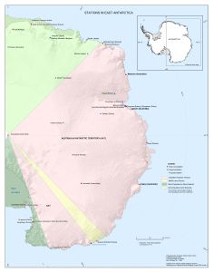
| 14256 | Stations in Antarctica [with the Australian Antarctic Territory shown, includes year-round and seasonal stations] |
2013 | 1 : 14 900 000 |
 |
| 14476 | Stations in Antarctica [with the Australian Antarctic Territory shown, includes year-round and seasonal stations] |
2015 | 1 : 14 900 000 |
 |
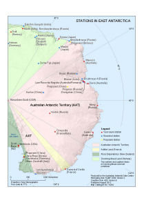
| 14349 | Stations in East Antarctica [with territorial claims shown, includes year-round and seasonal stations] | 2015 | 1 : 9 000 000 |
 |
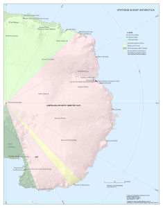
| 14244 | Stations in East Antarctica [with territorial claims shown, includes year-round and seasonal stations] |
2013 | 1 : 20 000 000 |
 |
| 14258 | Stations in East Antarctica [with territorial claims shown, includes year-round and seasonal stations] |
2013 | 1 : 9 000 000 |
 |
| 8182 | Structural-tectonic map of Antarctica | 1966 | 1 : 20 000 000 | |
| 8066 | Subglacial Soundings | 1972 | 1 : 15 000 000 | |
| 8065 | Subglacial Topography | 1972 | 1 : 15 000 000 | |
| 8059 | Submarine and Subglacial Topography | 1972 | 1 : 15 000 000 | |
| 8048 | Surface Sediments | 1991 | 1 : 11 674 000 | |
| 5357 | Sydishavet | 1962 | 1 : 3 250 000 |
 |
| 5362 | Sydishavet | 1964 | 1 : 10 000 000 | |
| 13553 | Sydishavet : fra 50 deg. til 73 deg. S.BR. og fra 110 deg.0. til 160 deg. V.LGD. | 1936 | 1 : 5 000 000 |
 |
| 13552 | Sydishavet : fra 50 deg. til 73 deg. S.BR. og fra 20 deg. til 110 deg. O.LGD. | 1936 | 1 : 5 000 000 |
 |
| 2326 | Syowa Station to South Pole-JARE Traverses 1957/69 | 1970 | 1 : 2 000 000 | |
| 8026 | Tectonic map of Antarctica | 1970 | 1 : 10 000 000 | |
| 8178 | Tectonic Map of Antarctica | 1980 | 1 : 10 000 000 |
 |
| 8049 | Tectonics and Age of the Crust | 1991 | 1 : 11 674 000 | |
| 13407 | Territorio Chileno Antartico 6000-5300 | 1972 | 1 : 10 000 000 | |
| 654 | Thala Dan 1959 / Mawson - Davis - Melbourne [Sheet 5] | 1959 | 1 : 1 000 000 |
 |
| 619 | Thala Dan 1961 [Sheet 6] | 1961 | 1 : 1 000 000 |
 |
| 609 | Thala Dan 1962 - 63 / Approach to Wilkes and Dalton Iceberg Tongue | 1963 | 1 : 1 000 000 |
 |
| 617 | Thala Dan 1962 - 63 / Wilkes - Dalton Iceberg Tongue | 1963 | 1 : 1 000 000 |
 |
| 582 | Thala Dan 1965 January / Melbourne - Wilkes [Approach to Wilkes] | 1965 | 1 : 1 000 000 |
 |
| 573 | Thala Dan 1966 / Tasmania - Casey via Dumont d'Urville | 1966 | 1 : 8 500 000 |
 |
| 576 | Thala Dan 1966 February / to and from Wilkes | 1966 | 1 : 1 000 000 |
 |
| 575 | Thala Dan 1966 January - February | 1966 | 1 : 1 000 000 |
 |
| 549 | Thala Dan 1967 / Wilkes Party plus 13 Frenchmen, Melbourne - Dumont d'Urville - Wilkes | 1967 | 1 : 8 500 000 |
 |
| 553 | Thala Dan 1967 January - February | 1967 | 1 : 1 000 000 |
 |
| 773 | Thala Dan Track Chart | 1959 | 1 : 1 000 000 | |
| 698 | Thala Dan Track Chart - 1957/58 / Casey Bay-Amundsen Bay-Cape Kinsey | 1958 | 1 : 1 000 000 |
 |
| 699 | Thala Dan Track Chart -1958 | 1958 | 1 : 1 000 000 | |
| 570 | Thala Dan Track Chart of Season 1969/70 | 1970 | 1 : 8 500 000 | |
| 3645 | The Antarctic Regions | 1932 | 1 : 16 000 000 |
 |
| 3428 | The Bedrock Surface of Antarctica | 1983 | 1 : 6 000 000 | |
| 3715 | The Course of Antarctic Exploration Between Longitudes 20°W and 110°E. | 1939 | 1 : 3 000 000 |
 |
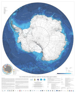
| 14227 | The International Bathymetric Chart of the Southern Ocean (IBCSO) | 2013 | 1 : 7 000 000 |
 |
| 3677 | The South Polar Regions to Illustrate the Paper by Staff Commander J.E. Davis. | 1869 | 1 : 16 000 000 |
 |
| 3427 | The Surface of the Antarctic Ice Sheet | 1983 | 1 : 6 000 000 | |
| 13087 | Topographic data managed by the Australian Antarctic Data Centre | 2004 | 1 : 6 000 000 |
 |
| 8053 | Total Magnetic Intensity (Epoch 1965) | 1968 | 1 : 15 000 000 | |
| 3499 | USAF Aerospace Planning Chart | 1962 | 1 : 9 000 000 | |
| 3494 | USAF Global Navigation and Planning Chart: Antarctica GNC26 | 1961 | 1 : 5 000 000 | |
| 3495 | USAF Global Navigation and Planning Chart: Antarctica GNC26N | 1961 | 1 : 5 000 000 | |
| 3490 | USAF Global Navigation and Planning Chart: Indian Ocean GNC22 | 1960 | 1 : 5 000 000 | |
| 13926 | USAF Global Navigation Chart GNC21 | 1983 | 1 : 5 000 000 | |
| 5722 | USAF Global Navigation Chart GNC26 | 1985 | 1 : 5 000 000 | |
| 8052 | Vertical Magnetic Intensity (Epoch 2965) | 1968 | 1 : 15 000 000 | |
| 814 | Vincennes Bay, Law Dome & Mawson University Shelf - 1956 & 1962/63 | 1963 | 1 : 1 000 000 | |
| 5848 | West Ice Shelf to Porpoise Bay | 1961 | 1 : 1 500 000 | |
| 3661 | West-central of five sheets - Copy of preliminary-reconaissance worksheet compiled from Operation Highjump photographs, part of ONR project 388-088 | 1955 | 1 : 1 000 000 | |
| 14611 | Wheeled runway in the Australian Antarctic Territory | 2017 | 1 : 15 000 000 |
 |
| 356 | Wilhelm II Land to George V Land | 1961 | 1 : 2 750 000 | |
| 357 | Wilhelm II Land to George V Land | 1976 | 1 : 2 750 000 | |
| 2715 | Wilkes | 1959 | 1 : 1 000 000 |
 |
| 5475 | Wilkes Land | 1975 | 1 : 2 500 000 | |
| 1199 | Wilkes Land | 1975 | 1 : 1 000 000 | |
| 413 | Wilkes Land - Compilation of Ship's Tracks, Bathymetric, Gravity & Magnetic Data | 1979 | 1 : 2 500 000 | |
| 2553 | Wilkes Land / South Victoria Land | 1954 | 1 : 4 000 000 |
 |
| 827 | Windmill Island area - Feb 1979 | 1979 | 1 : 1 000 000 | |
| 13140 | Windmill Islands [Black and white] | 2005 | 1 : 760 000 |
 |
| 14018 | Windmill Islands with Antarctica inset [Black and white] | 2012 | 1 : 393 385 |
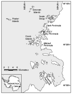 |
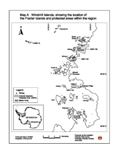
| 12932 | Windmill islands, showing the location of the Frazier Islands and protected areas within the region. | 2002 | 1 : 250 000 |
 |
| 5761 | World Aeronautical Chart. Sabrina Coast | 1959 | 1 : 1 000 000 | |
| 14609 | Year-round and seasonal stations in the Australian Antarctic Territory | 2017 | 1 : 15 000 000 |
 |
| 14608 | Year-round stations in the Australian Antarctic Territory | 2017 | 1 : 15 000 000 |
 |